Services
Comprehensive Surveying Solutions
Hydrographic Surveys
Key Services
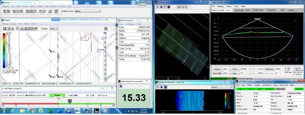
- Multibeam Echo Sounder (MBES) Surveys PEAS conducts high-resolution Multibeam bathymetric surveys in accordance with IHO C-13 and IHO S-44 Survey Order requirements, providing full-seafloor coverage and accurate depth measurements. Our MBES surveys support dredging control, navigational safety, seabed modeling, and detailed marine engineering design.
- Single Beam Echo Sounder (SBES) Surveys To measure water depths along defined survey lines for channel monitoring, volume calculations, reconnaissance surveys, and routine hydrographic assessments. SBES surveys provide cost-effective and reliable depth information where full seabed coverage is not required.
- Side Scan Sonar (SSS) Surveys To image and characterize the seabed surface for identification of objects, obstructions, debris, and seabed features. SSS surveys are used for pre- and post-dredging assessments, hazard detection, pipeline and cable route surveys, and marine infrastructure planning.
- Sub-Bottom Profiling Surveys To investigate subsurface sediment layers and shallow geological structures beneath the seabed. Sub-bottom profiling supports dredging design, sediment thickness evaluation, and assessment of seabed conditions for coastal and offshore engineering projects.
- Magnetometer Surveys To detect and locate ferrous metallic objects buried on or beneath the seabed, including wrecks, anchors, and unexploded ordnance. Magnetometer surveys help reduce construction risks and enhance safety for dredging and marine development activities.
- Dam and Reservoir Surveys Inspecting dam structures and reservoirs to assess sedimentation, water storage, and safety.
Oceanographic Studies
We conduct comprehensive oceanographic and metocean studies following IHO C-13 guidance, ISO, and recognized coastal Engineering standards. Our services cover Tidal observations, current measurements, wave analysis, and water column profiling, supporting safe marine operations, dredging design, coastal infrastructure planning, and environmental assessments.

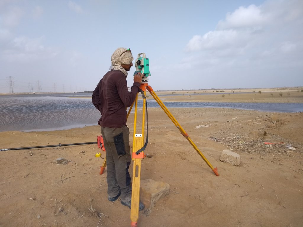
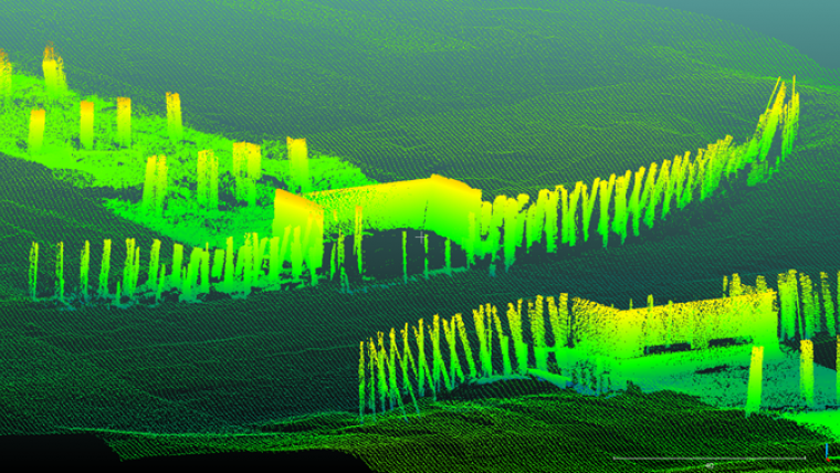
Topographic Surveys
Our topographic survey services are performed in compliance with international surveying standards, utilizing GNSS, total stations, and UAV-based mapping technologies. We provide accurate terrain models, contours, and geospatial data essential for infrastructure planning, coastal development, and integration with hydrographic and engineering design datasets.
Key Services
- Aerial Drone Survey
Using drones to capture aerial imagery and topographic data for mapping large areas, providing a cost-effective and efficient surveying method.
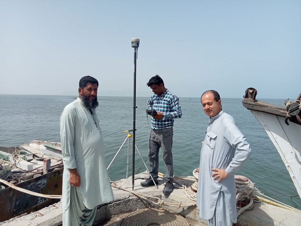
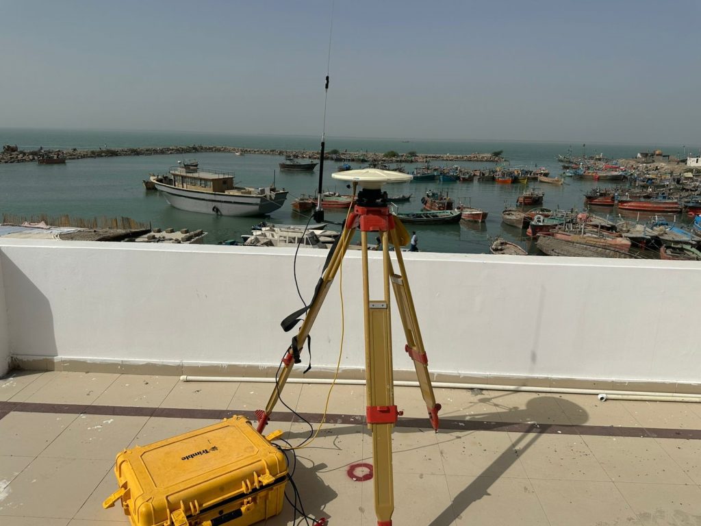
- RTK GNSS Profiles
Utilizing Real-Time Kinematic (RTK) GNSS systems for high-precision
Project & Contract Management Consultancy
PEAS offers professional consultancy services in Project and Contract Management, aligned with FIDIC conditions ,PEC and other applicable statutory frameworks. Our expertise includes project planning, procurement support, contract administration, claims management, and dispute avoidance, ensuring efficient project delivery, risk mitigation, and compliance throughout the project lifecycle.

Hydrographic & Geospatial Support Services
- Desktop & Feasibility Studies
We evaluate site suitability, environmental factors, regulatory compliance, and project risks to provide actionable insights for informed planning and decision-making.
- Survey & Data Acquisition
PEAS conducts high-precision hydrographic, geophysical, and topographic surveys using IHO-compliant methodologies and advanced survey equipment to collect reliable bathymetric and geospatial data.
- Data Processing & Analysis
Raw survey data is processed, validated, and transformed into accurate models, charts, and datasets ready for engineering analysis, seabed classification, and project design.
- Data Management & Archiving
We organize, store, and maintain geospatial and survey data using structured systems and metadata frameworks, ensuring integrity, accessibility, and long-term usability.
- Charting & Mapping
PEAS produces precise charts displaying water depths, seabed contours, obstructions, and seabed classifications, supporting navigation, dredging, and offshore construction projects.
- Web-Based Geospatial Visualization
Interactive web mapping platforms allow stakeholders to explore, query, and share project data easily, improving collaboration, transparency, and real-time decision-making.
- Reporting & Documentation
Comprehensive technical reports detail survey methods, results, interpretations, and recommendations, providing authoritative documentation for regulatory, engineering, and project management purposes.
- Client Representation & Coordination
We act as a liaison between stakeholders, contractors, and authorities, ensuring effective communication, smooth project execution, and compliance with technical and contractual requirements.
- Survey & Data Acquisition
PEAS conducts high-precision hydrographic, geophysical, and topographic surveys using IHO-compliant methodologies and advanced survey equipment to collect reliable bathymetric and geospatial data.
Technical Assistance & Advisory Services
- Technical Studies
We undertake detailed technical studies to evaluate engineering, operational, and site specific conditions, providing reliable inputs for planning, design, and implementation.
- Feasibility Studies
PEAS conducts feasibility studies to assess technical, financial, and operational viability of projects, supporting informed investment and development decisions.
- Planning Studies
Our planning studies focus on project sequencing, resource requirements, regulatory considerations, and risk assessment to ensure efficient and well-coordinated project execution.
- Estimation, Contract Documentation & Bid Preparation
PEAS prepares accurate cost estimates, contract documents, and bid submissions in line with project requirements, ensuring clarity, competitiveness, and contractual compliance.
- Quantity Surveying & Cost Estimating
We provide professional quantity surveying and cost estimating services to support budget control, cost planning, and financial management throughout the project lifecycle.
- Surveying, Valuation & Loss Assessment
PEAS delivers reliable surveying, valuation, and loss assessment services for assets and properties, supporting claims, insurance assessments, dispute resolution, and financial evaluations.